
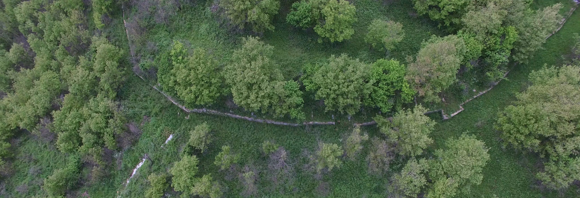
Drone view of Monte Torretta, spring 2019.
Field activities
2017
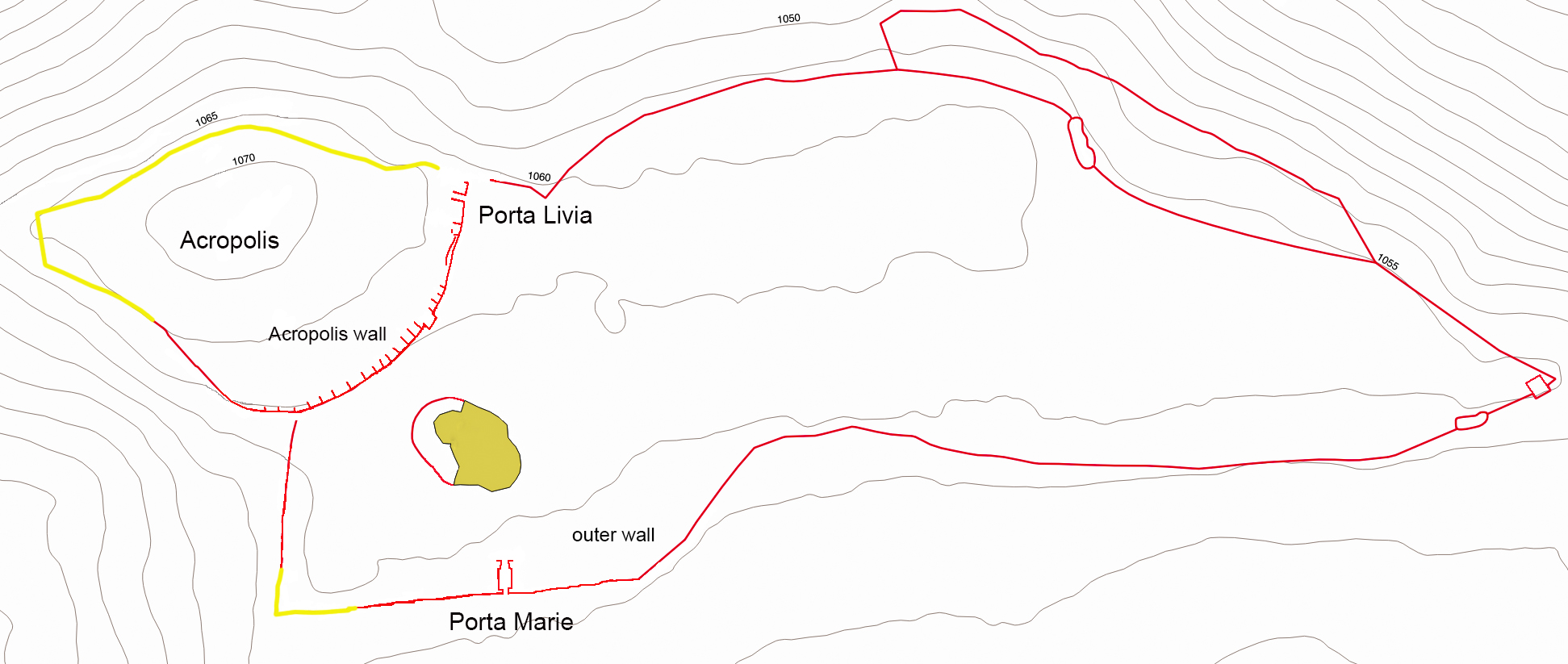
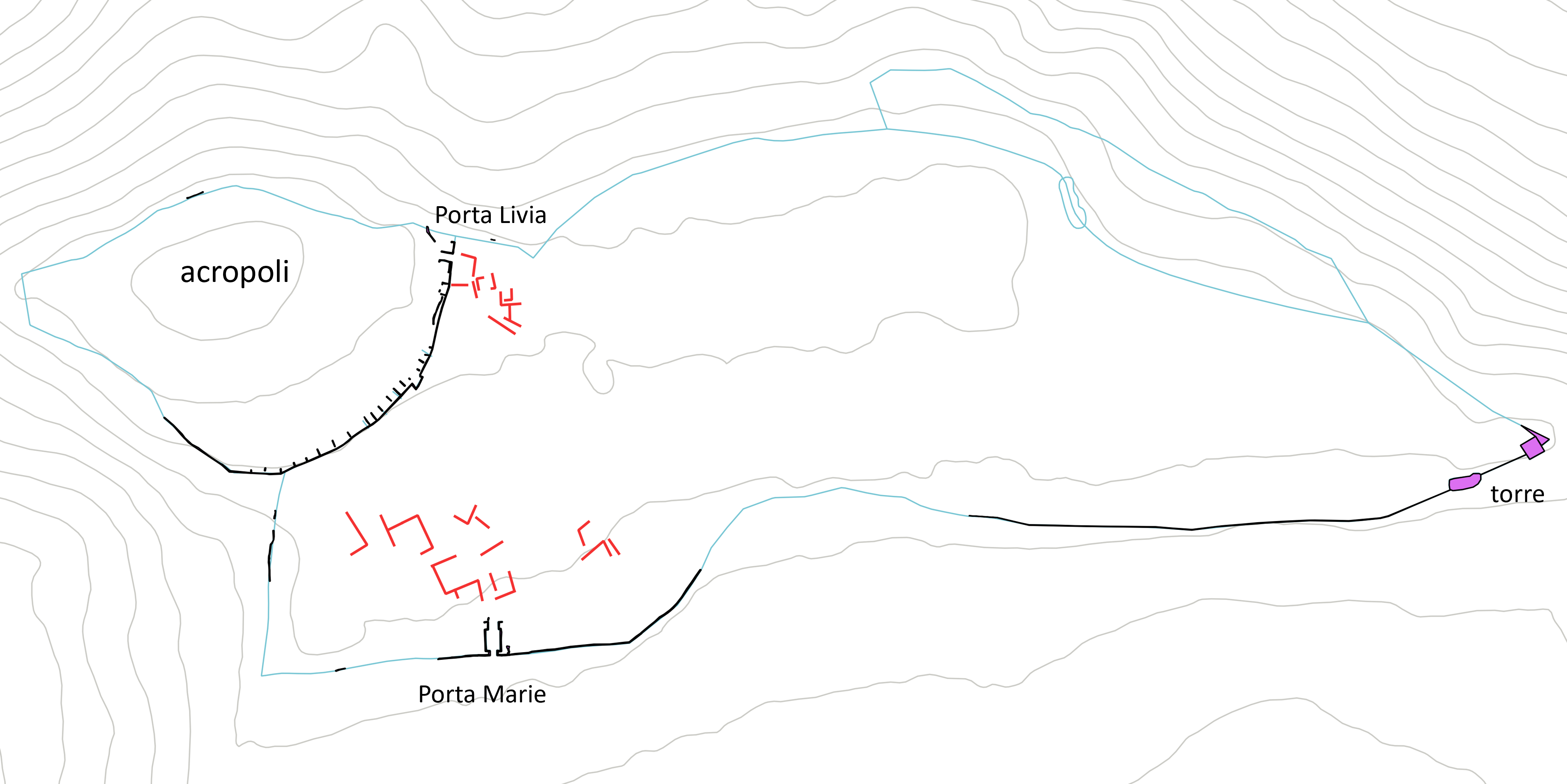
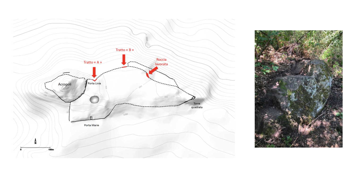
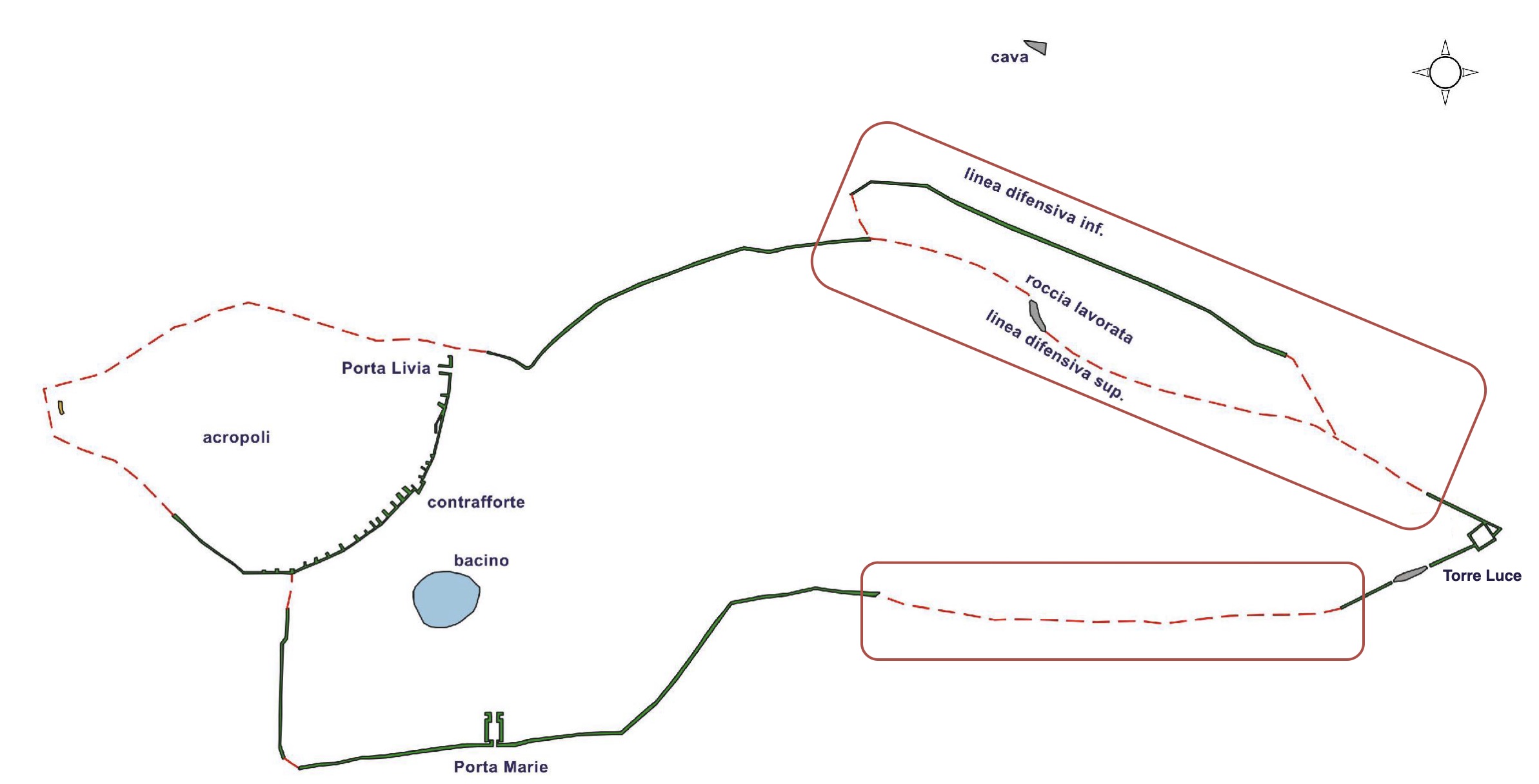
New topographical map, with main features.
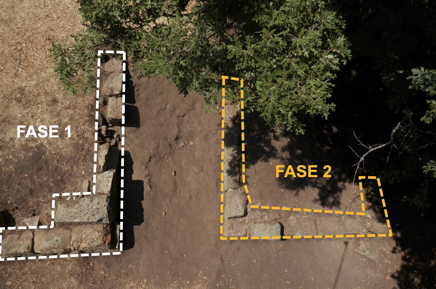
The main objective of this first field campaign was to obtain an overall view of the site and to survey the visible structures previously identified by earlier investigators. The situation on the ground immediately proved both rich and complex, showing that the planimetries then available required correction in several areas. On this occasion, conventional names were assigned to the two principal elements of the fortification system: Porta Livia designates the passage in the southern wall of the acropolis, while Porta Marie refers to the main gate of the outer enclosure. Topographical survey work concentrated on the summit of the site (the “acropolis”). This initial campaign brought to light a number of anomalies already hinted at by earlier maps, particularly with regard to access to the acropolis, which was clarified: it became clear that the internal floor level of Porta Livia rises towards the inner/walled area and, if there was a door with a locking system, it could only have been on the inside of the passage.
The 2017 campaign also revealed, on the northern slope of the acropolis, the presence of several parallel terrace walls, none of which display particularly distinctive features, thereby calling into question the notion—accepted until then and drawn here with a yellow line—of a single fortification line encircling the acropolis. By the end of this first field season, the whole issue of the fortified enclosure thus had to be reconsidered from an entirely new perspective.
Cleaning of Porta Livia. Photography by A. Bruscella
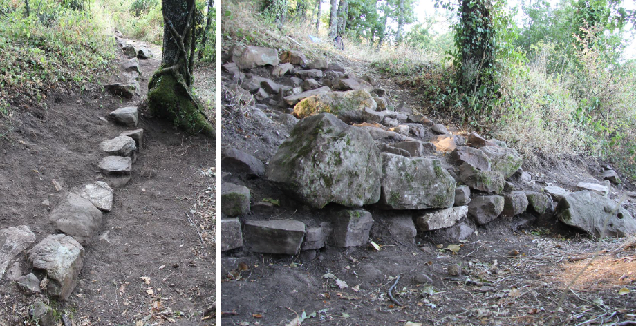
Cleaning of terrace walls on the northern slope of the acropolis.
2018
Topographical map: updated topographical survey (black), old topographical drawing (cyan), 2018 geophysical survey (red).
The objective of this second campaign was to pursue the topographical and archaeological survey in the western part of the site, focusing particularly on the acropolis and the Porta Marie.
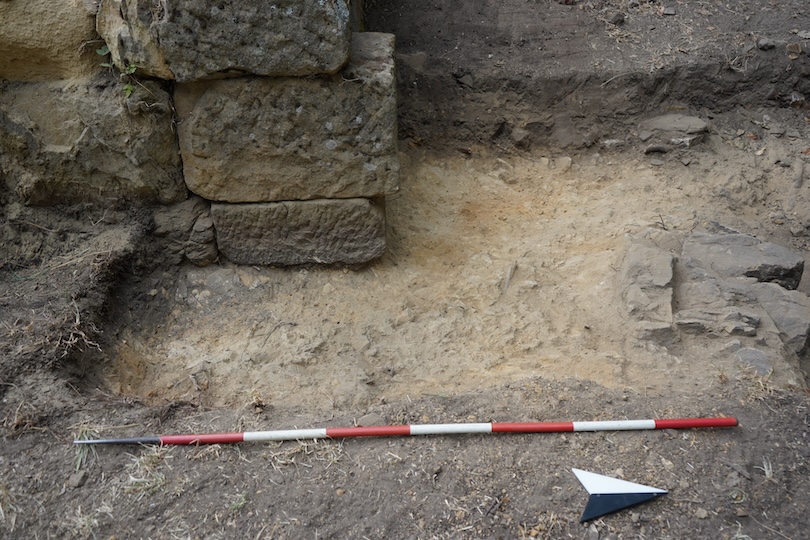
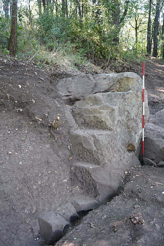
Stratigraphic evidence for the southern wall of the acropolis has been documented for the first time. At least three distinct phases of construction and use have been identified, the majority of the preserved remains belonging to the second phase. This second phase involved the addition of dividing walls set at variable intervals, designed to enable the acropolis retaining wall to withstand the pressure exerted by the sloping terrain and the natural flow of rainwater and meltwater. The wall was also equipped with a drainage system incorporating barbicans. Stratigraphic data further allow the (re)construction of the Porta Livia to be assigned to a third phase, following an episode of destruction and the partial collapse of the wall near the northern edge of the hill. Regarding the function of the southern wall of the acropolis, it appears to have served both as an enclosure wall—possibly incorporating a small defensive bastion—and as a retaining structure intended to stabilize the acropolis mound, with the dividing walls acting as anchors.
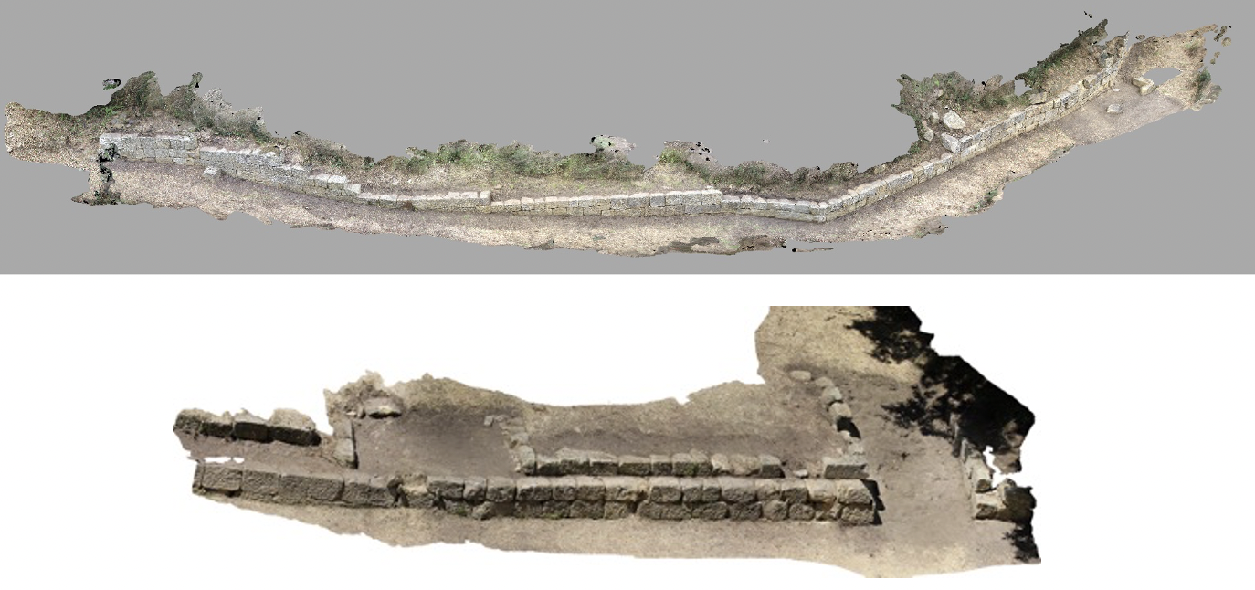
3D Photogrammetric model of the acropolis wall.
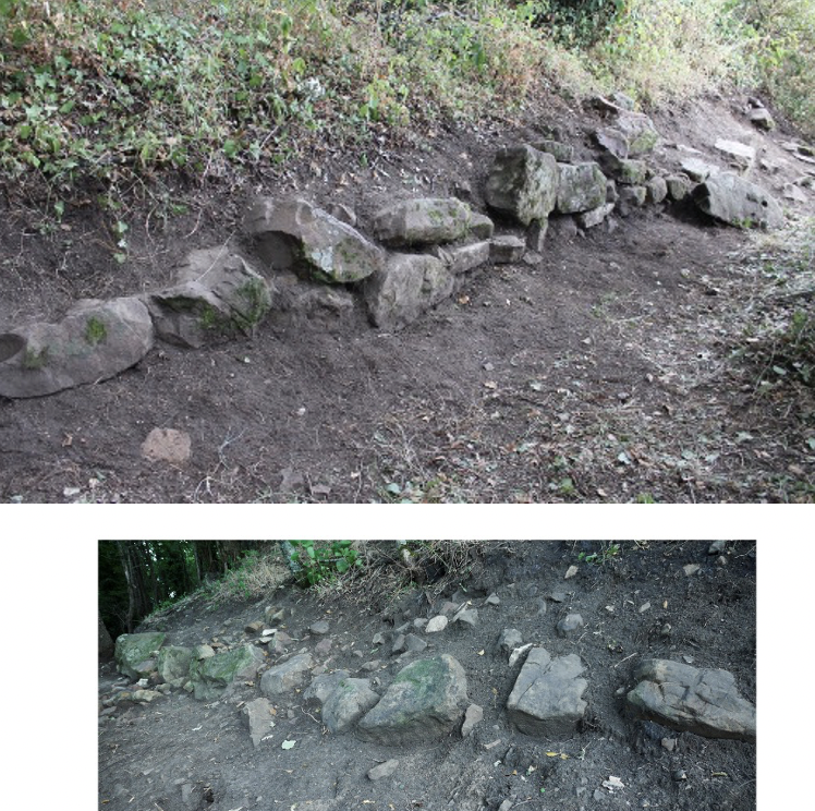
Terrace walls on the northern slope of the acropolis.
The topographical survey carried out on the northern slope of the acropolis also yielded new information. The terrace walls display a markedly different profile from both the outer settlement wall and the southern wall of the acropolis: their blocks are smaller and more irregular. Moreover, the remains of these terraces are highly fragmentary, consisting of discontinuous sections that make any connection to the southern part of the acropolis wall largely conjectural. This supports the interpretation that these are indeed terracing walls.
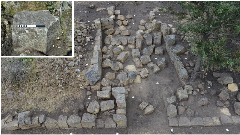
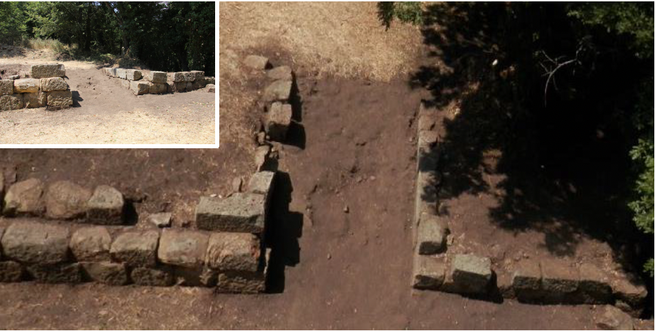
Porta Marie (detail: block of a vaulted superstructure).
The 2018 excavation campaign also brought to light the main entrance to the site—the Porta Marie—previously explored in 1989 by E. Setari. This gate, featuring an inner courtyard, presents a plan comparable to those of similar structures at sites such as Civita di Tricarico and Serra di Vaglio. Its state of preservation is particularly remarkable, allowing for a reconstructed elevation of at least two metres. The presence of a curved block further suggests the existence of a vaulted superstructure. This discovery underscores the site's scientific importance: Monte Torretta provides a valuable body of evidence for the study of military architecture in Basilicata and, more broadly, in southern Italy.
Finally, geophysical surveys conducted by the IMAA-CNR laboratory in the areas of the Porta Livia and Porta Marie revealed a significant number of wall alignments (in red on the plan above), attesting to a dense intramural occupation and an organized network of streets. Beyond clarifying the layout and construction of the circuit wall, these analyses contribute to bringing the very heart of the settlement back to life.
2019
The third field campaign was conducted in the summer of 2019, with the aim of obtaining new data on the functioning and chronology of the site's fortification system.
At the end of this campaign, it became clear that the previously published plans needed to be revised, particularly for the western sector of the acropolis. Although the presence of blocks at the foot of the slope confirms that a fortification curtain once existed in this area, the only securely attested stretch of wall is a double-faced segment, very partially preserved over a length of 8 m, whose blocks and construction technique differ entirely from those—apparently more recent—of the southern wall of the acropolis. Earlier scholars had reconstructed, without any direct evidence, a wall continuing westwards in line with the southern section of the acropolis wall, yet they were unable to identify any remains of such a structure. In the western sector, we were able to relocate a series of deep trenches running perpendicular to the slope, but none contained traces of this hypothetical wall.
A targeted intervention in the central part of the southern wall of the acropolis made it possible to determine its construction technique. The core of the wall consists of several very compact layers of mixed fill and a large quantity of clay soil, leaning directly against the sloping bedrock, with no inner facing wall identified so far. In its current state, the acropolis wall therefore resembles a retaining wall for a terrace, although the possibility cannot be excluded that an interior facing was constructed at a higher level, now lost, which would have provided a circulation walkway along the fortification. The embankments are separated by dividing walls, forming a series of caissons that served to contain the soil and distribute the pressure exerted by the slope. These arrangements probably belong to a major earth-moving programme on the acropolis, and the study of the associated pottery permits a terminus post quem for the construction of this wall at the end of the fourth century BC, an important stratigraphic dating for a Lucanian fortification.
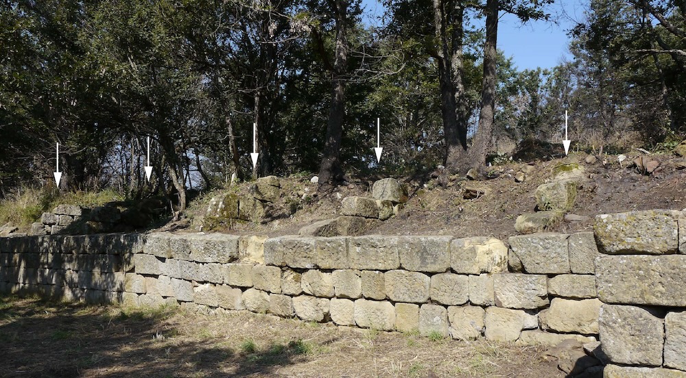
Acropolis wall with arrows indicating the dividing walls.
This phase also appears to include the main gate of the settlement, the Porta Marie, which was built using similar methods: a quadrangular structure with a supporting embankment leaning against the natural slope, without any preserved evidence of an inner facing wall.
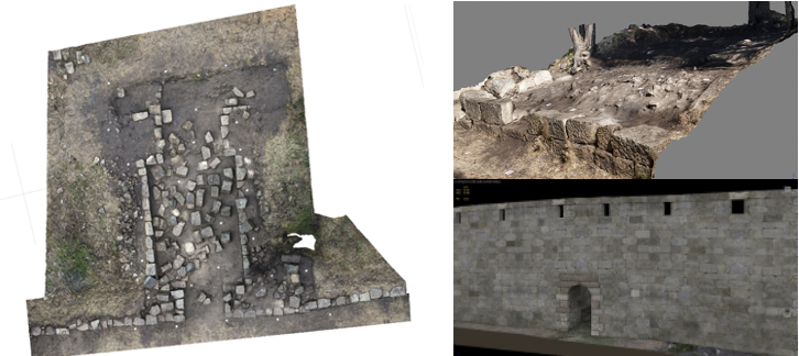
Porta Marie: orthophotography, 3D model of the excavated section and 3D reconstitution.
Investigation of the fortification system at the eastern end of the site brought to light a square tower excavated by Francesco Ranaldi in the 1950s. It is neatly bonded to the main enclosure wall on both its eastern and western sides, and a curious triangular annex is attached to its eastern face. This ground plan, which is quite unusual in southern Italy, points to the particular importance of this sector, where an old path used by shepherds and their flocks still passes today, most probably preserving the course of an ancient road. Analysis of the construction techniques reveals that the complex and the fortification wall were built in a single phase.
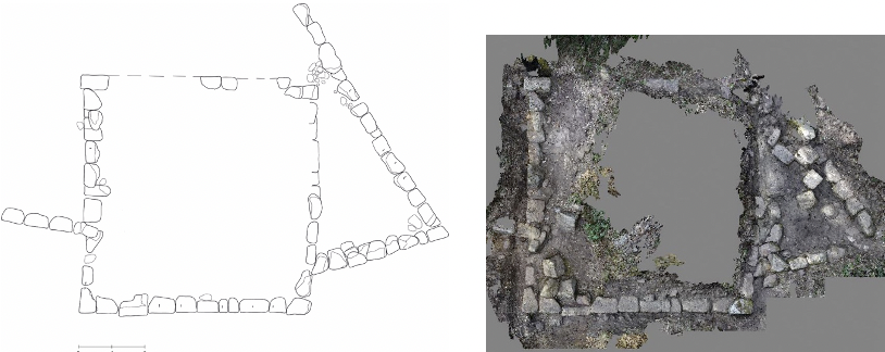
East tower: planimetry and 3D model.
2021
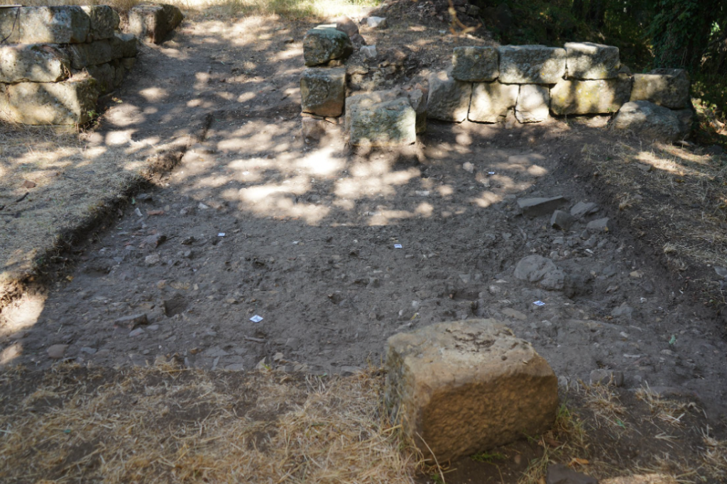
In front of Porta Livia.
The fourth campaign at Monte Torretta di Pietragalla was conducted in July and August 2021. The new investigations yielded fresh topographical and chronological data on the double wall circuit. A first key element concerns the relative chronology of the so‑called Porta Livia, the passageway that must have provided access to the upper sector of the site, conventionally referred to as the acropolis. Analysis of the masonry remains of this gateway, together with stratigraphic investigation of the levels in front of and partly beneath it, has confirmed the hypothesis already advanced in 2019: the Porta Livia visible today is certainly later than the construction of the acropolis wall, even though it is not yet possible to assign an absolute date to this intervention.
Sections of the northern wall investigated in 2021.
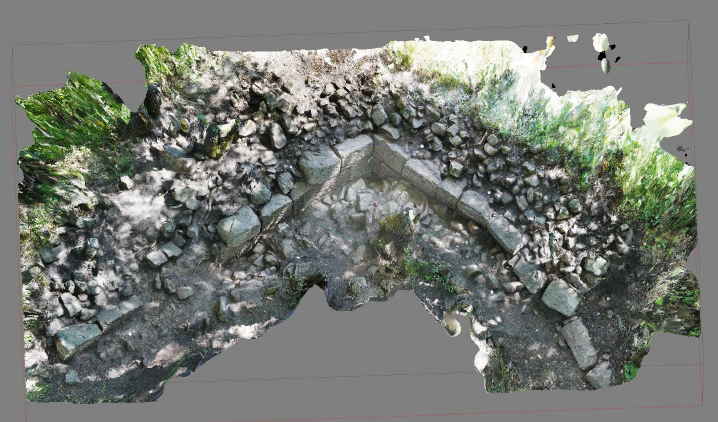
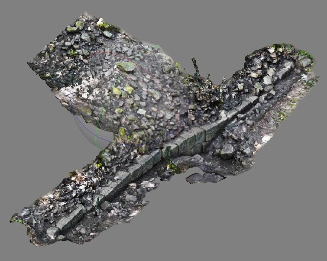
Further east, the rediscovery and cleaning of three earlier excavation trenches on the northern side of the outter wall, almost certainly dug by Francesco Ranaldi, made it possible at two points (section "A" and section "B") to intercept the main fortification wall of the settlement, as well as a portion of the rock outcrop, carefully cut into steps to allow the regular laying of at least four courses of masonry. Section "A" illustrates the remarkable technical skill of the wall-builders, who, for orographic and/or strategic reasons, had to create a 90° angle, achieved through the expert placement of blocks perfectly adapted to one another.
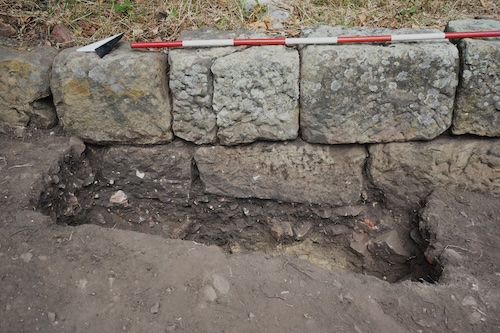
Crucial evidence for the construction technique of the boundary wall comes from section "B", which was examined over a length of more than 20 m. Here, cleaning operations showed that the wall consists of a single outer face of masonry built of almost regular blocks marked with Greek letters (here a ligature of alpha and rho, some of which are inverted), while the interior is filled with earth and stones of various sizes, which, on the basis of current documentation, gave the structure a total width of more than 5 m.
Section A with angle.
Section B (Photographic 3D model).
Section B: face and filling.
2022
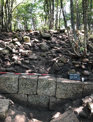
Between July and August 2022, the fifth topographic survey campaign was conducted at Monte Torretta di Pietragalla. This season brought significant new insights regarding the Porta Livia—the access point to the upper part of the site (the acropolis). Re-examination of the old excavation trenches opened by Francesco Ranaldi revealed that the two flanking walls of the gate actually belong to two distinct construction phases.
The southern flank, whose foundations rest on a compact layer of sand and gravel specifically levelled for this purpose, is contemporary with the rest of the acropolis wall and can be dated to the first half of the 3rd century BC. While this east-west wall section likely formed part of the access to the acropolis during this phase, it remains impossible to understand its planimetric articulation or its relationship with the main circuit wall, which must have run approximately 9 m further north.
In contrast, the northern flank of the Porta Livia—built rather summarily using reused blocks—was erected above a fill level deposited after the construction of the acropolis wall. Pending its dating, we can already note that this rectangular masonry structure, whose function remains far from clear, was not connected to the main circuit wall, which may no longer have been in use at this time.
The two construction phases of Porta Livia.
Foundation level of the first phase of Porta Livia (southern flank).
Detail of the second phase of Porta Livia (northern flank).
Regarding the main circuit wall itself, the rediscovery and cleaning of numerous excavation trenches opened by Ranaldi provided precise confirmation for the southern side—already substantially known in its overall course—and new topographic data for the northern side, particularly its eastern half. For this latter section, we are working on the hypothesis of two lines of defense at different elevations: a lower one to the north and an upper one approximately 20 m further south.
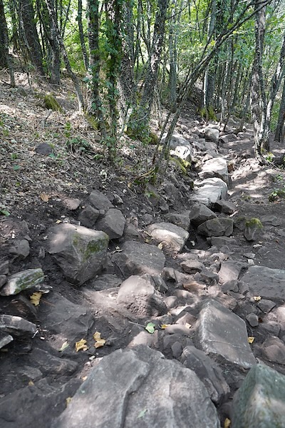
However, while the lower alignment can be followed for a total length of approximately 190 m with a more or less irregular state of preservation, the existence of the upper alignment is currently indicated only by a portion of bedrock elegantly cut into steps to allow the placement of a wall section not otherwise found. Despite the limited nature of this discovery, it should be remembered that a similar solution exists on the southern slope of the site, west of the square tower, where the circuit wall is actually present. Pending future confirmation, it is not entirely implausible to imagine that the lower defense line constitutes an expansion of the fortification system that would have utilized blocks from the upper alignment—whether purposely dismantled or already collapsed.
Also on the northern slope, the survey led to the discovery of numerous rock formations both inside and outside the circuit wall. One of these, particularly imposing, is characterized by a series of rather sharp and regular oblique cuts, which could be related to stone extraction operations. Further possible confirmation of this hypothesis could come from the presence of small oblong cavities visible at various points, perhaps interpretable as traces of tools related to this activity. We may be looking at the remains of one of the quarries used, among other things, in the context of the major construction project related to the fortification system erected in the single construction phase currently verifiable during the first half of the 3rd century BC.
 The lower defense line (orthophoto and view from below).
Rock elegantly cut into steps.
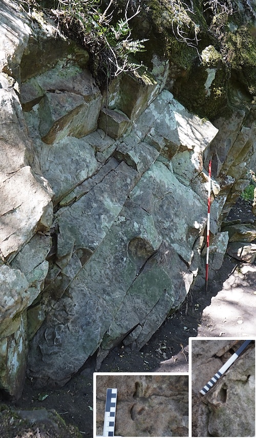
Tool marks on natural rock (possible quarry).
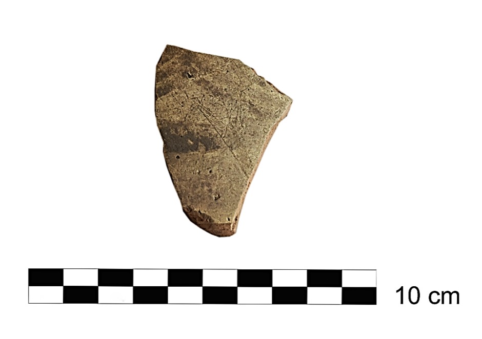
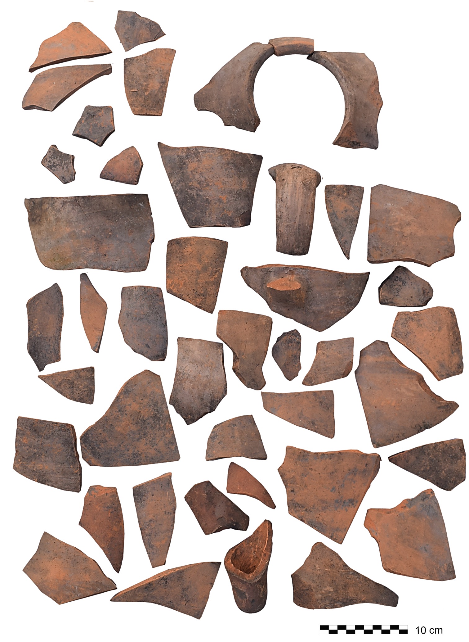
Although not yet complete, the examination of ceramic finds provides interesting data regarding the phases of occupation and the use of products from extra-regional provenance. An initial occupation of the site by at least the 8th century BC is confirmed, as suggested by spindle whorls, impasto pottery fragments, and matt-painted pottery with tent decoration in "hollow style". Among the recovered materials, a Punic-Sicilian transport amphora similar to the Solus-Panormos 4.5/Ramón-Greco T-4.2.2.7 type (4th–early 3rd century BC) stands out as evidence of direct or indirect commercial contacts with the western Mediterranean. However, it should be noted that the use of amphorae at Monte Torretta is poorly attested, similarly to what is known in the rest of the indigenous hinterland. The final phase of occupation appears to extend into the 2nd century BC, as indicated—within the limits of typological reliability—by some black-glazed plates with L-shaped profiles and pithoi with triangular-section rims. This datum is of considerable importance and requires a precise verification of the known chronologies for other sites in the same territory.
Matt-painted pottery with tent decoration (8th c. BC).
Punic-Sicilian transport amphora (4th–early 3rd c. BC).
2023
Between July and August 2023, the sixth topographic survey campaign was conducted at Monte Torretta di Pietragalla. The main objective of this campaign was to complete the documentation of the fortification system in sectors where it had not yet been possible to carry out an accurate topographic survey—specifically the north-eastern and south-eastern slopes.
Location of Monte Torretta and plan of the Hellenistic fortification system, with indication of the sectors investigated in 2023 (red dashed lines indicate wall sections then reconstructed hypothetically).
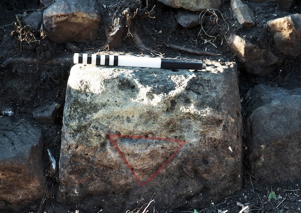
Inverted delta incised on block in situ (south-eastern section).
It was thus possible to verify with precision the course of the south-eastern section, previously known only from old surveys in a relatively summary manner. Despite the presence of very extensive collapse areas, cleaning operations and surface clearing brought to light, in addition to old excavation trenches, very extensive wall alignments, albeit preserved for the most part only in their foundations. The wall seems to adapt perfectly to the orography of the area, which reveals a slight but constant east-west slope, with minor changes in direction.
The working of the blocks with assembly marks, as well as the presence of letters incised on the face with a predominance of the delta, reveal a uniform construction technique between the outer wall and the acropolis wall. Confirmation that the two walls belong not only to the same phase—during the first half of the 3rd century BC—but also to the same construction project also comes from the results achieved on the north-eastern slope.
Indeed, a few metres west of the rectangular tower (the so-called Torre Luce), immediately below the humus layer, a transverse wall was intercepted, absolutely analogous in technique and structure to the numerous transverse walls already known for the acropolis wall. The presence of this cross-wall is probably related to the need to consolidate the fortification wall in an area characterized by a very steep slope. To date, this is the only cross-wall found in connection with the outer wall—however, we cannot exclude that the thick layers of humus and collapse conceal the same solution in other sectors.
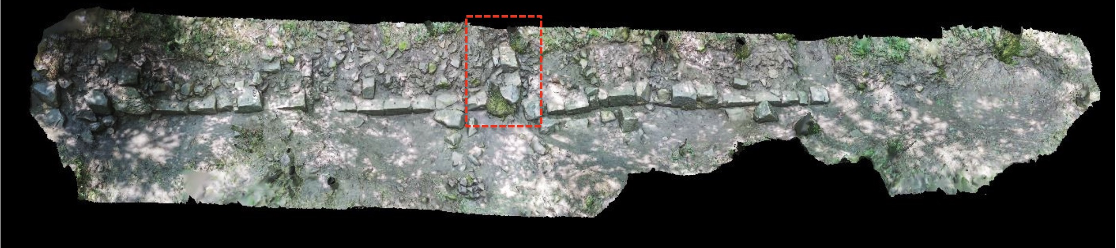
Photogrammetric survey of the north-eastern section of the fortification system immediately west of Torre Luce (the transverse wall is shown in red).
The north-eastern section of the fortification certainly raises considerable difficulties in interpretation. The area is indeed marked by at least two major landslides that seem to have caused the definitive disappearance of large portions of the circuit wall. Thus, already during the 2022 campaign, two lines of defense located at different elevations were hypothesized: a lower one to the north, which can be followed for a total length of approximately 190 m, and an upper one approximately 20 m further south, currently indicated only by a portion of bedrock elegantly cut into steps. Whether the currently preserved lower line constitutes a reconstruction of a first wall placed at a higher elevation and already collapsed in antiquity is one of the working hypotheses that only systematic excavation can confirm. Such an intervention could also make it possible to verify the presence of at least one additional gate in the circuit wall—beyond the already known Porta Marie—which would have connected the fortified area with the northern slopes of the site, characterized moreover by a water source still perfectly visible today.
Certainly, the construction of the walls must have involved a substantial modification of the previous settlement, indicated by sporadic bronze finds recovered in correspondence with the south-eastern section and certainly pertaining to funerary contexts of the Archaic period. These discoveries confirm what was already suggested by the archaic materials from Francesco Ranaldi's excavations regarding the existence of a complex and socially differentiated community well before the erection of the walls, in relation to additional inhabited nuclei located in the area immediately south-east of Monte Torretta, where surface sampling made it possible to recover ceramic material datable between the 6th and 4th centuries BC and related to domestic and funerary contexts.
Sustainable Archaeology and Community Engagement
Beyond archaeological research in the field, the Pietragalla Project is also a sustainable archaeology project, aimed at disseminating scientific results to the local community and promoting the heritage value of the Monte Torretta di Pietragalla site. In this context, we received the decisive contribution of the local association La Gorgone, which provided cleaning of the site in preparation for archaeological work but also organized various archaeo-trekking events to Monte Torretta, with guided tours designed to raise awareness in the local community about the archaeological and forest heritage of the site.
Alongside these activities and in order to transform the site into a true archaeological park—at the moment, although subject to archaeological constraints, the entire site consists of a series of private properties—the officials of the Soprintendenza della Basilicata are proceeding with the demarcation of the area to be subjected to expropriation as part of a program financed by the Ministry of Culture. The transformation of the site's legal status will finally make it possible to initiate the first systematic excavation operations, inaugurating a new and decisive era for the site of Monte Torretta di Pietragalla.
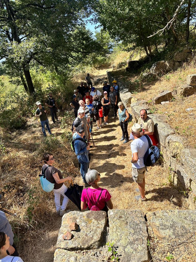
Guided tour organized by the association La Gorgone.